As many of us know, hurricane season is upon us, and that means the Atlantic states will be enduring severe storms, flash floods, strong winds, rain and hail, and quite possible tornado offshoots. And with all of these hazards come the risk of extreme damage to your property and to your very life. Last year, Hurricane Ida was a heavy-hitting Category 4 hurricane that decimated Louisiana, damaged New Jersey, New York, and other Atlantic coastal states. To see an example of some of the carnage left behind in New Orleans, watch this YouTube video from the Washington Post by clicking here.
As a new season begins, meteorologists, emergency managers, utility companies, and residents who live in high-risk areas should always maintain vigilance and keep track of all the hurricane and tropical storms that manifest. But why should we keep tabs on those storms that are not in our area? Simple answer is–we cannot depend on the predicted hurricane path. As many of us have learned or research from the infamous Galveston hurricane back in the early 1900’s weather stations in the US predicted the hurricane’s path would take a detour and head off elsewhere away from the gulf. Several warnings from Cuban meteorologists advising the US that the hurricane was headed straight to the Texas island wasn’t enough to convince Americans, until it was too late. While advanced satellite imaging technology and practices have made hurricane tracking more accurate, no one or thing can accurately predict a hurricane’s path 100% of the time.
Tropical Storm Two
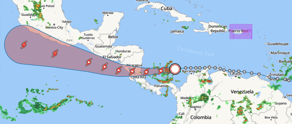
Tropical Storm Two is a potential storm that is currently building up in northern Venezuela as you read this. Although it has a projected path to head west, hurricanes can and will change paths unexpectedly.
In this image above, we can see the projected path of Tropical Storm Two heading west, and a potential to grow into a Cat 1 hurricane by July 1st, 2022. While a Cat 1 hurricane may not pose a great risk, given specific conditions, the tropical storm may well grow into a Cat 1 or a Cat 2 hurricane, especially if it changes direction before making landfall in Nicaragua, heads north to Cuba, and strengthens further while feeding of the warm temperatures and cool waters.
Conclusion
Pretty simple, everyone that resides or knows of someone who resides in a hurricane-prone area should continuously monitor their local weather station and keep updated of the latest storm watches and warnings. As hurricane season starts to heat up, this will be an excellent opportunity to prepare your household, business, or your community for the incoming hurricanes. For more information on how to be ready and get ready, feel free to browse our website, blogs, survival tips, or visit Ready.gov for your disaster preparedness needs.
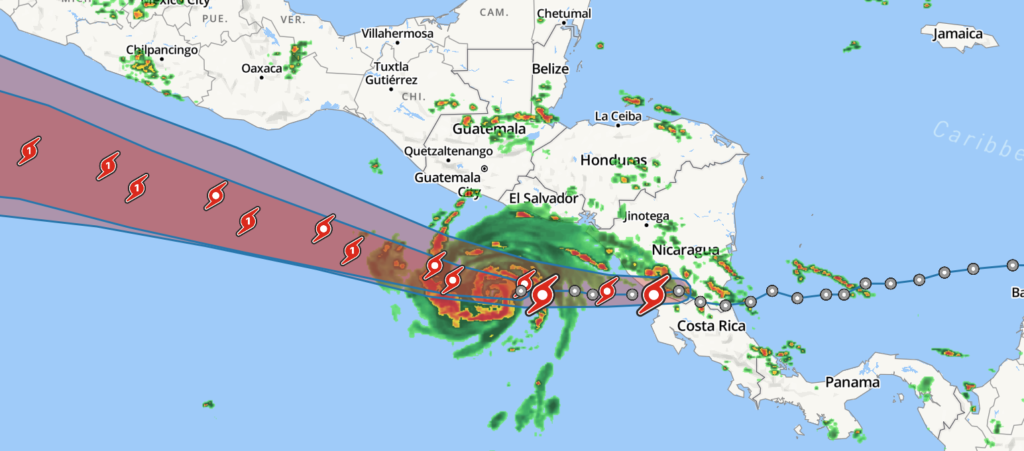
Update 6.29.2022
The Tropical storm Two has continued down the projected path of heading west toward the Pacific Ocean. It is projected to pass through Northern Costa Rica and southern Nicaragua strengthening into a Category 1 hurricane as it is touches down on the Pacific Ocean with a possibility of heading northwest along the southern coast of Mexico. More updates will follow.
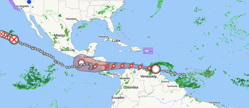
Updated 6.30.2022
Tropical Storm Two has continued down its projected path since yesterday. Currently, TS Two is cruising west along the Caribbean. While it’s good that the TS is not destroying buildings at this time, cruising along the Caribbean Sea does provide those warm water temperatures that it needs to fuel it up, building up strength for when it hits Latin America. What does that mean in simple terms? Simply that the winds, rain, storms will be stronger. We can expect TS Two to make landfall in Costa Rica on July 2nd. Stay safe as we continue to bring updates.
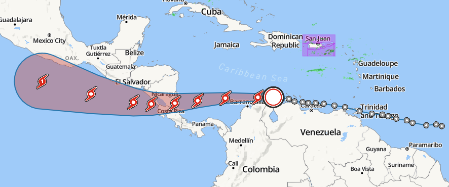
Update 07.02.2022 -Tropical Storm Bonnie
TS Two has finally been upgraded and was given the name Tropical Storm Bonnie, due to the fact that it will strengthen into a Category 1 hurricane in the next day. While that may sound unpleasant for individuals in the impact zone, the tropical storm has exited Latin America and is continuing its path west deeper into the Pacific Ocean, where it will strengthen into a Cat 1 hurricane and dissolve in the deep ocean blue.
One thing unique about Bonnie, as it predecessor name suggested, Bonnie is actually two storms in one. TS Two was used to describe two storms that were travelling synonymous with the smaller storm inside the bigger storm. Hurricane Bonnie is the name of the smaller storm travelling inside the bigger storm, Tropical Storm Two, which is not labeled as TS Bonnie. TS Bonnie will continue to travel west into the Pacific Ocean, while the smaller TS Bonnie will gain strength, grow into a Cat 1 hurricane, and continue further into the Pacific Ocean. All of this can be confusing but the one thing we can be sure of is that currently, these two storms do not pose a threat to human lives, livestock, and infrastructure.
We will continue to provide period updates until the storms die off.